The right Bible atlas can turn a difficult passage into a clearer, more memorable discussion. For small groups, the best options balance readable maps with historical background, timelines, geography, and enough detail to support thoughtful study without overwhelming the room.
We selected ten Bible atlases with different strengths, from quick-reference map collections and student-friendly guides to richly illustrated resources for deeper group preparation. Use the guide below to match your group’s size, study style, and preferred level of detail.
Best 10 Bible Atlases for Small Groups Picks for 2026
Context-Rich Choice
Rose Then and Now Bible Map Atlas

- 120+ maps with explanatory notes
- Modern-location overlays and travel routes
- Profiles 30 important biblical characters
Best For: Groups wanting geography, culture, and character context
Quick Reference Pick
Holman QuickSource Bible Atlas
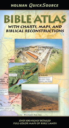
- More than 300 visual resources
- Covers major biblical events and journeys
- Compact 1.44-pound format
Best For: Groups needing broad, portable visual reference
Most Portable Option

- 17 full-color then-and-now maps
- Fold-out design fits most Bibles
- Covers biblical regions and Paul’s journeys
Best For: Groups needing fast modern-location comparisons
Visual Overview
National Geographic Atlas of the Bible

- Concise 112-page format
- Focuses on exploring the Holy Lands
- Large enough for shared viewing
Best For: Groups wanting a slim introduction to biblical geography
Best Visual Bible Map Insert

- 22 full-color maps with eight transparent overlays
- Compares biblical and modern locations
- Compact 44-page format fits most Bible covers
Best For: Portable, quick-reference group studies
Best Comprehensive Bible Atlas

- More than 175 full-color maps
- Adds photos, 3-D reconstructions, and timelines
- Includes 65,000 words of narrative context
Best For: Detailed, discussion-led Bible geography study
Best Group Teaching Visuals
Rose Bible Charts, Maps & Time Lines

- 230 full-color pages with 200+ reusable visuals
- Includes six new themes in the anniversary edition
- Spiral binding supports group teaching use
Best For: Visual lessons and group-leading support
Best Budget-Friendly Pick

- 30 maps covering both Testaments
- Place-name index and archaeology guide
- Revised, accessible layout
Best For: Introductory small-group and family study
Classic Illustrated Reference

- Illustrated Bible-lands atlas
- By Harry Thomas Frank
- Published by Hammond World Atlas Corporation
Best For: Groups seeking a classic visual reference
Most Comprehensive Historical Scope
The Bible Atlas of Maps and Plans

- Covers both Testaments and the Apocrypha
- Includes maps, site plans, and journey routes
- Digital reproduction of an 1868 reference
Best For: Groups wanting detailed historical and topographical context
Context-Rich Choice – Rose Then and Now Bible Map Atlas
For small groups looking for bible atlases for small groups, the Rose Then and Now Bible Map Atlas adds substantial explanation to its maps. It combines more than 120 maps with modern overlays, Bible references, travel routes, and background on 30 important biblical characters.
Best For: Small groups that want to connect geography, culture, biblical characters, and story context during discussion.
Pros:
- Includes more than 120 detailed maps with helpful notes and travel directions.
- Clear overlays compare biblical locations with modern cities and countries.
- Explores how geography and culture influenced the lives of 30 biblical characters.
- Provides Bible references and explanatory text rather than maps alone.
Cons:
- At 272 pages and 3.1 pounds, it is less convenient for highly portable group study.
- Its people-focused, topical approach may be less suitable for readers seeking only chronological maps.
This is a strong discussion-oriented atlas when your group wants more than location data. Its size and depth make it better for a leader’s reference table or shared study resource than for carrying inside a Bible.
Quick Reference Pick – Holman QuickSource Bible Atlas
The Holman QuickSource Bible Atlas is a practical option for bible atlases for small groups that need broad coverage in a relatively portable format. It brings together more than 300 maps, charts, photos, and biblical reconstructions covering major Old and New Testament events.
Best For: Small groups that need a compact, fast-reference overview of biblical geography and major biblical journeys.
Pros:
- Combines more than 300 maps, charts, photos, and reconstructions.
- Covers topics from Abraham’s journeys and the Exodus through Jesus’ ministry and Paul’s missions.
- At 1.44 pounds, it is considerably easier to carry than a larger atlas.
- Organized around key biblical topics for quick consultation.
Cons:
- Its compact reference format may provide less extended explanation than a larger atlas.
- The supplied details emphasize broad coverage rather than modern-location overlays or character studies.
Choose this atlas when your group values range and convenience. It is especially useful for quickly locating visual context during a discussion without bringing a heavy reference volume.
Most Portable Option – Then & Now Bible Maps
For groups seeking highly portable bible atlases for small groups, Then & Now Bible Maps is a fold-out supplement rather than a full-length atlas. Its 17 color maps compare biblical places, empires, and journeys with modern boundaries and locations.
Best For: Groups that want a quick visual aid for identifying where biblical places are located today.
Pros:
- Includes 17 full-color maps covering major biblical regions and journeys.
- Modern cities and countries are shown alongside biblical locations.
- Fold-out design fits inside most Bibles and extends to 38 inches.
- Covers topics including the Twelve Tribes, Jesus’ ministry, empires, and Paul’s journeys.
Cons:
- As a 14-panel pamphlet, it offers less explanatory depth than a bound atlas.
- The format is designed primarily for map comparison and quick reference, not extended background study.
This is an excellent add-on for a group that already has study resources but frequently asks, “Where is that today?” Its slim format makes it easy to pass around or keep with a Bible, though it is not a substitute for a comprehensive atlas.
Visual Overview – National Geographic Atlas of the Bible
The National Geographic Atlas of the Bible: Exploring the Holy Lands is a slim-format choice to consider among bible atlases for small groups. Its 112-page format and National Geographic presentation make it suited to readers who want an accessible introduction to the Holy Lands without carrying a large reference book.
Best For: Small groups seeking a concise, visually oriented introduction to the Holy Lands.
Pros:
- Offers a relatively brief 112-page format for easier group handling.
- Focuses on exploring the Holy Lands, keeping the subject centered on biblical geography.
- Its 8-by-10.88-inch dimensions provide a useful page size for shared viewing.
Cons:
- The supplied details do not specify the number of maps, charts, photos, or other included features.
- At 0.26 inches thick, it may be less comprehensive than a full-length atlas.
- The available information does not indicate whether it includes modern-location overlays or detailed study notes.
This atlas makes the most sense when a group prefers a concise introduction over an extensive reference work. Because the supplied description provides limited feature detail, compare its contents with your group’s need for maps, commentary, and discussion support.
Best Visual Bible Map Insert – Then and Now Maps
For small groups seeking practical bible atlases for small groups, the Then and Now Bible Maps Insert is a compact option for quickly connecting biblical locations with modern geography. Its larger type, full-color maps, timelines, index, and transparent overlays make it useful when a group needs a fast visual reference without passing around a large atlas.
Best For: Small-group leaders and members who want a lightweight, Bible-cover-sized geography aid with modern-location comparisons.
Pros:
- Includes 22 full-color maps and eight clear plastic overlays.
- Shows biblical places alongside modern cities and countries.
- Covers major biblical locations, Paul’s journeys, timelines, charts, and an index.
- Ultra-thin 44-page format fits inside most Bible covers.
Cons:
- Its 44-page insert format is less comprehensive than a full-size atlas.
- The small format may provide less room for extended group study notes.
This is a strong choice when portability and quick geographic orientation matter more than extensive narrative commentary or photographic detail.
Best Comprehensive Bible Atlas – Crossway ESV Bible Atlas
The Crossway ESV Bible Atlas is a substantial choice for groups looking for bible atlases for small groups with broad geographic coverage and supporting visuals. It combines more than 175 full-color maps with photographs, 3-D reconstructions, timelines, indexes, and 65,000 words of narrative, giving leaders material for deeper context-based discussions.
Best For: Established small groups that want a detailed reference book for studying biblical geography, history, and regional context.
Pros:
- Offers more than 175 full-color maps and 70 photographs.
- Includes 3-D recreations of biblical objects and sites.
- Provides regional maps for areas including Egypt, Mesopotamia, Italy, and Greece.
- Combines maps with timelines, indexes, narrative descriptions, and online resources.
Cons:
- Its 352-page, 2.31-pound format is less portable than a compact insert.
- The extensive content may be more than a group needs for quick weekly reference.
Choose this atlas when your group values depth, visual variety, and historical explanation, especially for a leader who can keep the larger reference book available during discussion.
Best Group Teaching Visuals – Rose Bible Charts, Maps & Time Lines
For leaders comparing bible atlases for small groups with broader teaching resources, the Rose Book of Bible Charts, Maps & Time Lines offers a visual, presentation-friendly format. Its 230 full-color pages and more than 200 reusable visuals are designed to simplify complex biblical concepts for personal study, group leading, and religious teaching.
Best For: Small-group leaders who want reusable charts, maps, and timelines to support lessons and explain difficult concepts visually.
Pros:
- Includes 230 full-color pages and more than 200 reusable visuals.
- Adds six new themes in the 10th Anniversary Edition.
- Durable spiral binding supports comfortable use while teaching.
- Designed for personal study, group leading, and religious instruction.
Cons:
- It is a broad charts-and-teaching resource rather than a dedicated geographic atlas.
- The large 11.02-by-8.46-inch format may be less convenient for carrying to meetings.
This book is a practical fit when visual teaching aids matter as much as map coverage, but groups seeking detailed geographic reference may prefer a dedicated atlas instead.
Best Budget-Friendly Pick – The Student Bible Atlas
For groups looking for accessible bible atlases for small groups, The Student Bible Atlas offers a concise introduction to biblical geography. Its revised layout includes 30 maps covering both Testaments, plus a place-name index and a guide to major Middle Eastern archaeological sites.
Best For: Small groups, families, and younger Bible students who want a straightforward, budget-conscious reference.
Pros:
- Includes 30 maps covering the Old and New Testaments.
- Features a helpful index of place names.
- Includes a guide to major archaeology sites of the Middle East.
- Revised edition with updated, crisp map layouts.
Cons:
- Its 32-page format may be too brief for advanced study.
- The reading-age and grade-level details suggest a primarily introductory audience.
This is a practical choice when your group values clarity, portability, and broad coverage over extensive scholarly detail.
Classic Illustrated Reference – Atlas of the Bible Lands
Atlas of the Bible Lands is a classic illustrated option to consider among bible atlases for small groups. The supplied information identifies it as a 1997 work by Harry Thomas Frank and lists Hammond World Atlas Corporation as the publisher, making it a potentially useful visual supplement for discussion-based study.
Best For: Groups interested in a classic illustrated Bible-land reference and older atlas editions.
Pros:
- Designed as an illustrated atlas of the Bible lands.
- Associated with author Harry Thomas Frank.
- Published by Hammond World Atlas Corporation.
Cons:
- The supplied notes do not specify map count, page length, or included study features.
- Its 1997 publication date may mean some material is less current than newer editions.
Because the available details are limited, compare the listing carefully if your group needs specific maps, historical coverage, or teaching aids.
Most Comprehensive Historical Scope – The Bible Atlas of Maps and Plans
The Bible Atlas of Maps and Plans offers an unusually broad historical scope for groups comparing bible atlases for small groups. This reproduction of Samuel Clark’s 1868 work covers the Old Testament, New Testament, and Apocrypha with historical and topographical maps, city and building plans, and journey maps.
Best For: Study groups that want detailed historical geography, biblical site plans, and visual context for major journeys.
Pros:
- Covers the Old Testament, New Testament, and Apocrypha.
- Includes historical and topographical maps.
- Provides plans of sites such as Jerusalem and the Temple.
- Maps journeys associated with Abraham, Moses, and Paul.
Cons:
- It is a reproduction of an 1868 work, so its historical presentation may feel dated.
- The Kindle print-replica format has no enhanced typesetting or page flip.
- The 64.4 MB file may be less convenient on devices with limited storage.
This is the strongest fit for groups prioritizing breadth and historical detail, provided they are comfortable with an older reference work in digital print-replica form.
How We Picked the Best Bible Atlases for Small Groups
We focused on resources that help several people follow a discussion together, not just books designed for solitary academic research. Our evaluation emphasized map clarity, geographic accuracy, historical and cultural context, coverage of both Testaments, portability, page layout, and how easily a leader can use the atlas during preparation or a live session.
We also included a range of formats. Some atlases prioritize concise explanations and quick lookup, while others offer larger visual spreads, detailed regional studies, timelines, or historical perspectives. Because groups vary widely, there is no single best format for every church, class, or home study.
Quick Comparison
| Best For | Look For |
|---|---|
| Fast discussion reference | Compact maps, indexes, and concise captions |
| Visual learners | Color illustrations, charts, and large map spreads |
| Leader preparation | Historical background, cultural notes, and timelines |
| Students and new readers | Simple explanations and uncluttered layouts |
| Detailed study | Broader geographic coverage and topographic detail |
Key Buying Factors for Bible Atlases for Small Groups
Readability and Map Design
Maps should be large enough to share or easy to reproduce for handouts. Check whether place names are legible, routes are clearly marked, and ancient locations are connected to modern geography. A visually impressive atlas is less useful if members cannot quickly find the relevant city or region.
Context Beyond the Map
Look for concise notes about political boundaries, travel routes, customs, archaeology, and historical events. These details can give leaders useful conversation starters and help the group understand why geography matters in a passage.
Scope and Organization
Choose an atlas that matches your curriculum. A quick-reference volume may be ideal for weekly meetings, while a more comprehensive work is better for leaders preparing a series. An index, chronological structure, and clear section headings save time.
Format and Durability
Consider whether the book will stay on a leader’s desk, travel to meetings, or be passed around a table. A compact paperback is convenient, while a larger hardcover may provide better map visibility and durability. For a group, confirm that the layout works when the book is opened flat or viewed by more than one person.
Who Should Buy Which Bible Atlases for Small Groups?
Choose a quick-reference atlas if your group needs answers during discussion and prefers short explanations. A student-oriented atlas is a strong fit for beginners, youth groups, or mixed-experience classes. Groups that enjoy visual teaching should prioritize books with charts, timelines, illustrations, and generously sized maps.
For leaders planning an in-depth series, select a resource with substantial historical and geographic commentary. If your meetings focus on specific journeys, cities, or land divisions, prioritize detailed regional maps and route coverage. Older or historical atlases can be valuable supplemental references, but buyers should expect dated terminology, scholarship, and cartography.
Ultimately, the best Bible Atlases for Small Groups are the ones members can read quickly and discuss confidently. Match the atlas’s depth to your meeting time, choose clarity over sheer page count, and consider pairing a compact reference with a more detailed leader resource when your group needs both convenience and depth.