The best Bible atlases make biblical geography easier to understand by combining accurate maps with historical background, photographs, timelines, and cultural context. They can clarify journeys, kingdoms, cities, and changing borders that are difficult to visualize from a text-only study Bible.
This roundup compares 10 Bible atlases for different needs, from detailed reference works and full-color visual guides to accessible options for students, families, and classroom teaching.
Best 10 Bible Atlases Picks for 2026
Best Visual Reference

- 3-D and multidimensional maps
- 100+ new images and chronological charts
- Detailed geographical dictionary and index
Best For: In-depth visual study of biblical geography and history
Best Historical Context

- 132 maps and 100+ photographs
- Organized around biblical history and texts
- Covers peoples, empires, roads, and daily life
Best For: Teaching and contextual Bible study
Best for Teaching
Deluxe Then and Now Bible Maps

- Eight overlays show modern geography
- Spiral binding lies flat
- Large type and reproducible classroom pages
Best For: Sunday school, homeschool, and group Bible studies
Best Comprehensive Mapping

- 175+ maps and 70 photographs
- Satellite imaging and GIS-informed presentation
- 3-D reconstructions and online resources
Best For: Detailed regional and historical Bible geography study
Best Visual Guide

- More than 300 visual resources
- Covers major biblical events
- Compact and portable format
Best For: Beginners and group Bible study
Best for Context
Rose Then and Now Bible Map Atlas

- More than 120 detailed maps
- Modern location overlays
- Profiles 30 Bible characters
Best For: Context-focused Bible readers
Best Academic Reference
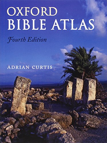
- 27 full-color maps
- Includes archaeology and chronology
- Useful indexes and further reading
Best For: Students and serious Bible researchers
Visual Holy Lands Guide
National Geographic Bible Atlas

- National Geographic publication
- Focused on the Holy Lands
- Compact 112-page format
Best For: Readers seeking a concise Holy Lands reference
Classroom-Friendly Choice

- 30 maps across both Testaments
- Includes a place-name index
- Covers major Middle East archaeological sites
Best For: Children and beginning Bible students
Illustrated Family Explorer

- Maps Old and New Testament locations
- Includes illustrations and photos
- Designed for ages 9–12
Best For: Families and visual learners
Best Visual Reference – Zondervan Atlas of the Bible
Zondervan Atlas of the Bible: Revised Edition, Full-Color Maps, Photos, Graphics, and More
Check Price On AmazonIf you want a comprehensive resource for studying bible atlases, the revised Zondervan Atlas of the Bible combines full-color maps, photographs, graphics, and chronological presentation. It moves from an introduction to the lands of biblical history through the Old and New Testaments, then adds Jerusalem history and a detailed geographical dictionary.
Best For: Bible students and serious readers who want an expansive, visually rich reference organized around biblical history.
Pros:
- Includes multidimensional and three-dimensional maps.
- Features more than 100 new relevant-to-topic images.
- Offers chronological charts, graphics, a geographical dictionary, and an index.
- Provides 304 pages of historical and geographical material.
Cons:
- Its 2.6-pound, large-format design may be less convenient for casual carrying.
- The breadth of material may be more than beginners need for quick map lookups.
This is a strong all-around choice when visual presentation and depth matter. Its revised text and reference tools make it especially useful for extended study rather than occasional browsing.
Best Historical Context – Holman Bible Atlas
Holman Bible Atlas: A Complete Guide to the Expansive Geography of Biblical History
Check Price On AmazonThe Holman Bible Atlas is a practical pick among bible atlases for readers who want geography connected directly to biblical history. It combines 132 full-color maps, more than 100 photographs, timelines, charts, and sidebars with coverage of ancient peoples, empires, roads, agriculture, and economic life.
Best For: Teachers, pastors, and students who want biblical events arranged alongside their geographical, historical, and cultural context.
Pros:
- Includes 132 full-color maps and more than 100 color photographs.
- Arranges content around biblical history from the patriarchs through the Christian era to Constantine.
- Connects material to specific biblical texts.
- Covers people groups, empires, road systems, agriculture, and ancient economies.
Cons:
- At 3.25 pounds, it is the heaviest of these listed atlases.
- Its broad cultural and historical coverage may feel extensive for simple route checking.
Choose this atlas if context is as important to you as location. Its combination of visual material and text-linked historical coverage makes it well suited to lessons, sermons, and structured study.
Best for Teaching – Deluxe Then and Now Bible Maps
For classrooms, homeschool settings, and Bible studies, Deluxe Then and Now Bible Maps offers an accessible alternative to larger bible atlases. Its relief maps use eight clear plastic overlays to place modern cities and countries over biblical locations, while the spiral binding lets pages lie flat during group use.
Best For: Sunday school teachers, homeschool families, and readers who prefer hands-on comparisons between biblical and modern geography.
Pros:
- Eight transparent overlays compare modern places with Bible maps.
- Spiral binding keeps pages flat when open.
- Uses larger type and includes reproducible classroom material.
- Adds maps, charts, and timelines covering Bible stories, empires, and key journeys.
Cons:
- At 66 pages, it is less comprehensive than a full-length historical atlas.
- Its interactive teaching format may not satisfy readers seeking extensive narrative analysis.
This is the most activity-friendly option in the group. The overlays and larger type make geographical comparisons easy to demonstrate, while the compact format keeps it manageable for lessons and study tables.
Best Comprehensive Mapping – Crossway ESV Bible Atlas
The Crossway ESV Bible Atlas stands out among bible atlases for its combination of extensive mapping, satellite-imaging advances, photographs, 3-D reconstructions, and readable narrative. It includes regional maps of areas such as Egypt, Mesopotamia, Italy, and Greece, plus timelines, indexes, and online map and illustration access.
Best For: Readers who want a detailed, technically informed atlas with broad regional coverage and substantial explanatory text.
Pros:
- Includes more than 175 full-color maps and 70 photographs.
- Uses satellite imaging and geographic information systems in its presentation.
- Adds 3-D reconstructions, timelines, indexes, and 65,000 words of narrative.
- Provides regional maps and access to online maps and illustrations.
Cons:
- Its 352-page, large-format design may be more reference-oriented than portable.
- The technical scope may be more than readers need for quick devotional consultation.
With the highest page count and largest map collection here, this atlas is a compelling choice for readers who value breadth and modern mapping methods. It balances technical detail with readability for sustained study.
Best Visual Guide – Ultimate Bible Atlas
If you want a portable introduction to bible atlases, the Ultimate Bible Atlas combines more than 300 full-color maps, charts, photos, and biblical reconstructions. Its coverage follows major biblical events from Abraham’s journeys and the Exodus through Jesus’ ministry, Passion Week, and Paul’s missionary journeys.
Best For: Beginners, personal Bible study, and small-group activities that benefit from a compact, highly visual reference.
Pros:
- Includes more than 300 maps, charts, photos, and reconstructions.
- Covers key biblical places and events across both Testaments.
- Compact 4.8-by-7-inch format is easy to carry and use.
Cons:
- Its beginner-friendly presentation may offer less depth than a specialist academic atlas.
- The compact format provides less page space than larger atlases.
Choose this edition when accessibility and visual variety matter most. The revised, expanded format packs substantial geographical context into a convenient reference for everyday study.
Best for Context – Rose Then and Now Bible Map Atlas
Many bible atlases show locations without explaining their significance. The Rose Then and Now Bible Map Atlas adds cultural and biographical context to more than 120 maps, including modern overlays, travel directions, and background on 30 important Bible characters.
Best For: Readers who want to connect geography with the decisions, journeys, and circumstances of familiar biblical figures.
Pros:
- Combines more than 120 detailed maps with explanatory background.
- Clear overlays connect biblical places with modern cities and countries.
- Explores how geography affected people such as David, Naomi, and Moses.
- Includes travel-direction lines, Bible references, and cultural insights.
Cons:
- At 3.1 pounds and 8.6 by 11 inches, it is less portable than a compact atlas.
- Its people-centered approach may be less suitable for readers seeking a strictly chronological survey.
This is a strong choice if map study feels incomplete without historical and cultural explanation. Its topical, character-focused organization helps translate geography into practical insight about biblical narratives.
Best Academic Reference – Oxford Bible Atlas
For readers comparing bible atlases with an emphasis on scholarship, the fourth-edition Oxford Bible Atlas offers 27 full-color maps, 81 color illustrations, historical coverage, and an archaeology survey. It places biblical geography within the wider ancient Near Eastern and eastern Mediterranean settings.
Best For: Students and serious readers who want an authoritative overview supported by chronology, indexes, archaeology, and further-reading suggestions.
Pros:
- Revised with recent biblical scholarship and archaeological discoveries available for its edition.
- Includes 27 full-color maps and 81 color illustrations.
- Covers biblical history from Genesis and the Exodus through Jesus and the early Church.
- Provides chronology, place-name and general indexes, and further reading.
Cons:
- Its 2009 publication date means it is older than some newer reference works.
- The academic scope may be more than casual readers need.
The Oxford edition stands out as a structured reference rather than a lightweight browsing book. Its combination of maps, historical periods, archaeology, and research aids makes it especially useful for coursework and sustained study.
Visual Holy Lands Guide – National Geographic Bible Atlas
The National Geographic Atlas of the Bible is a compact choice for readers seeking a visually oriented introduction to bible atlases. Published by National Geographic, it focuses on exploring the Holy Lands in an English-language, 112-page format.
Best For: Readers who want a concise Holy Lands reference from a recognizable geographic publisher.
Pros:
- Published by National Geographic.
- Focuses on exploring the Holy Lands.
- Compact 8 x 10.88-inch format with 112 pages.
Cons:
- Its 112-page length may be limited for readers wanting an extensive reference work.
- The supplied details do not specify coverage of particular biblical events, maps, or archaeological sites.
Choose this atlas when portability and a focused Holy Lands presentation matter more than a highly detailed or comprehensive study resource.
Classroom-Friendly Choice – The Student Bible Atlas
The Student Bible Atlas is a practical option for families, classrooms, and beginning Bible students comparing bible atlases. This revised edition includes 30 maps covering both Testaments, a place-name index, and a guide to major Middle East archaeological sites.
Best For: Children and introductory learners, especially those studying biblical journeys and geography.
Pros:
- Includes 30 maps covering the Old and New Testaments.
- Provides a place-name index and an archaeology-sites guide.
- Revised edition with redesigned layouts and updated maps.
- Recommended reading range includes ages 9–12.
Cons:
- The supplied details list only 32 pages, so coverage may be concise.
- Its student-focused presentation may be less suitable for advanced scholarly research.
Its clear, accessible structure makes it one of the more useful picks for introductory study, though advanced readers may want a fuller reference alongside it.
Illustrated Family Explorer – The Bible Atlas
The Bible Atlas from DK Children offers an illustrated, story-connected approach to bible atlases. Its maps cover biblical locations and journeys, while additional illustrations, photos, and explanations explore daily life, rulers, and how places look today.
Best For: Readers ages 9–12 and families who prefer visual explanations alongside Bible stories.
Pros:
- Covers events from both the Old and New Testaments.
- Follows journeys of patriarchs, Jesus, and Paul.
- Combines maps with illustrations, photos, and historical context.
- Includes a look inside Solomon’s Temple and information about modern locations.
Cons:
- The 66-page format may not provide exhaustive geographic detail.
- The supplied edition details indicate some digital features, including enhanced typesetting and page flip, are not enabled.
This is a strong fit when engagement and visual storytelling are priorities, particularly for younger readers rather than specialist research.
How We Picked These Bible Atlases
We looked for atlases that connect geography with the biblical narrative rather than presenting maps without explanation. Our comparison considers map clarity, historical coverage, archaeological and cultural context, visual quality, organization, and usefulness for study or teaching. We also included a range of formats, from academically oriented references to approachable pictorial atlases.
Because readers use these books differently, no single atlas is ideal for everyone. A serious researcher may value chronological detail and extensive commentary, while a student or casual reader may prefer clear layouts, photographs, and concise explanations.
Quick Comparison
- Best all-around reference: Zondervan Atlas of the Bible, Revised Edition
- Best for broad historical coverage: Holman Bible Atlas
- Best for visual comparison: Deluxe Then and Now Bible Maps
- Best for ESV readers: Crossway ESV Bible Atlas
- Best for photographs and reconstructions: Ultimate Bible Atlas
- Best for cultural context: Rose Then and Now Bible Map Atlas
- Best traditional reference: Oxford Bible Atlas
- Best geographic photography: National Geographic Atlas of the Bible
- Best for students: The Student Bible Atlas
- Best pictorial introduction: The Bible Atlas from DK
Key Buying Factors for Bible Atlases
Map Quality and Readability
Look for maps with legible labels, useful scales, clear legends, and enough geographic detail to follow routes and locations. A beautiful map is less helpful if text is too small or borders and terrain are difficult to distinguish.
Historical and Biblical Scope
Check whether the atlas covers the full biblical period or focuses on a particular era. Helpful volumes organize maps around events such as the Exodus, Israelite kingdoms, the exile, and the journeys of Jesus and Paul.
Visual and Teaching Features
Photographs, timelines, charts, diagrams, site plans, and reconstructions can make unfamiliar places easier to remember. These features are especially valuable for group study, homeschooling, and classroom instruction.
Depth and Portability
More comprehensive atlases often provide stronger reference value but may be larger and denser. Choose a substantial volume for desk study, or a lighter, more visual edition if you expect to carry it to church, class, or travel.
Who Should Buy Which Bible Atlases?
Choose a comprehensive reference such as the Zondervan, Holman, or Oxford atlas if you want detailed study material that you can consult repeatedly. The Crossway ESV Bible Atlas is a natural choice for readers who primarily use the ESV and want an integrated companion.
For readers who learn visually, the National Geographic, Ultimate, DK, and Then and Now editions emphasize photographs, comparisons, maps, and reconstructions. Students and newcomers may find The Student Bible Atlas easier to navigate, while Rose’s atlas is a strong option for readers who want geography explained alongside biblical background and culture.