When it comes to understanding scripture, illustrated biblical atlases can be invaluable tools. They not only provide essential maps and visuals but also offer cultural and historical insights that deepen your comprehension. With various options available, from extensive atlases to those tailored for younger audiences, choosing the right one can enhance your study experience. So, which atlases stand out, and how can they transform your approach to scripture? Let’s explore the top contenders.
Biblical World, The: An Illustrated Atlas

If you’re keen on exploring the historical and cultural backdrop of the Bible, “The Biblical World: An Illustrated Atlas” is your go-to resource. This extensive atlas by National Geographic offers informative maps, stunning photographs, and engaging essays, making it an affordable reference. You’ll appreciate the detailed comparisons of modern and ancient sites that enhance your understanding of the Holy Land. Readers rave about its educational value, beautiful visuals, and balanced presentation of biblical interpretations. Whether you’re studying the Bible or planning a visit, this atlas is a valuable addition to your library, serving as an insightful supplement to your studies.
Best For: This atlas is best for anyone interested in the historical and cultural context of the Bible, including students, educators, and travelers planning to visit the Holy Land.
Pros:
- Beautiful visuals and engaging content enhance the educational experience.
- Balanced presentation of conservative biblical interpretations alongside modern scholarship.
- Detailed comparisons of ancient and modern sites aid in understanding biblical geography.
Cons:
- Limited number of maps compared to other National Geographic publications.
- Some readers may find it lacks the depth of detail present in other similar works.
- Not all readers may agree with the interpretations presented, depending on their personal beliefs.
Zondervan Atlas of the Bible: Revised Edition

For anyone seeking an extensive visual guide to biblical history and geography, the Zondervan Atlas of the Bible: Revised Edition stands out as a top choice. This atlas features high-quality maps and photographs, ensuring a visually engaging experience. Divided into two sections, it provides both historical context and a chronological journey from Noah to Christ. You’ll find valuable appendices, including glossaries and a geographic dictionary, perfect for deeper exploration. Users rave about its thoroughness and insightful illustrations, making it an excellent resource for Bible studies and anyone interested in ancient history. It’s highly recommended for both teens and adults!
Best For: The Zondervan Atlas of the Bible: Revised Edition is best for teenagers and adults seeking a comprehensive visual guide to biblical history and geography.
Pros:
- High-quality maps and photographs enhance the visual experience.
- Extensive appendices, including glossaries and a geographic dictionary, support deeper research.
- Highly recommended for Bible studies and those interested in ancient history.
Cons:
- The hardcover format may be less portable than a paperback version.
- Some users may find the depth of information overwhelming for casual reading.
- Limited focus on specific modern applications or interpretations of biblical texts.
St. Joseph Atlas of the Bible: 79 Full-Color Maps

The St. Joseph Atlas of the Bible features 79 full-color maps, images, charts, and diagrams that bring biblical stories to life. You’ll find that it enhances your understanding, especially when used alongside a Bible in a Year reading plan. With detailed maps and commentary, this atlas caters to both adults and children, making it a versatile study companion. Users love the glossy pages, which prevent bleed-through, though some wish for a larger, premium version. Overall, many recommend it as an invaluable tool for enriching your Bible study experience and gaining insights into both historical and modern contexts.
Best For: Individuals seeking a comprehensive and visually engaging resource to enhance their Bible study, particularly those following a Bible in a Year reading plan.
Pros:
- Detailed and colorful maps enhance understanding of biblical stories.
- Suitable for both adults and children, making it a versatile study tool.
- Glossy pages prevent bleed-through, ensuring durability during use.
Cons:
- Some users desire a larger edition with a premium cover for better quality.
- Additional content or features could further enrich the atlas.
- Long-time Bible students might seek more in-depth historical comparisons.
The Complete Illustrated Children’s Bible Atlas

Designed specifically for children ages 4 to 10, “The Complete Illustrated Children’s Bible Atlas” stands out as an engaging educational resource. It offers scripture-backed, concise information, making it a valuable tool for young learners. The colorful pictures and maps grab kids’ attention, sparking their interest in biblical stories. This atlas proves to be an excellent teaching book, perfect for homeschooling or Sunday school settings. With a focus on the Old covenant, it helps children explore key countries and places in the Bible. Highly recommended, it’s a fabulous way to captivate young minds while they learn about scripture.
Best For: Children ages 4 to 10 who are learning about the Bible and its stories.
Pros:
- Scripture-backed information that enhances educational value for young learners.
- Colorful maps and illustrations that engage children’s interest and curiosity.
- Practical for use in homeschooling and Sunday school settings.
Cons:
- Focus primarily on the Old Testament may limit exposure to New Testament content.
- The atlas may not cover every biblical story or location in detail.
- Some illustrations may not resonate with all children, depending on personal preferences.
Oxford Bible Atlas
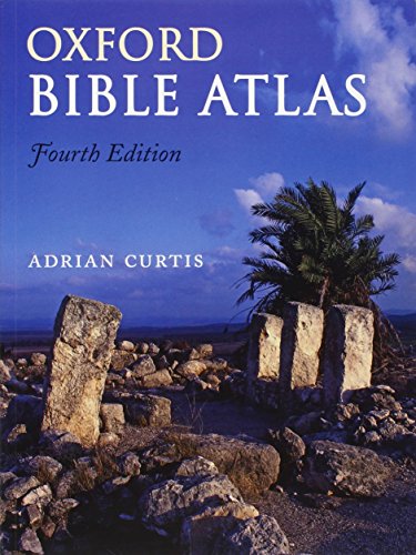
If you’re seeking a thorough resource that beautifully combines maps, photographs, and historical context, the Oxford Bible Atlas is an outstanding choice. Regarded as the best Bible atlas available, its detailed maps and stunning color photographs enhance your understanding of Scripture. The well-organized place index and narrative chronology of major events make it user-friendly. While some users note minor issues like page number placement, the atlas remains a valuable tool for both casual readers and serious students. Its combination of informative text and visuals makes it perfect for connecting biblical places and names as you dive deeper into your study.
Best For: Anyone looking to deepen their understanding of the Bible through comprehensive maps, photographs, and historical context.
Pros:
- Detailed, easy-to-read maps and stunning color photographs enhance visual learning.
- Well-organized place index and narrative chronology facilitate navigation and context.
- Suitable for both casual readers and serious students of the Bible, making it a versatile resource.
Cons:
- Some users report issues with page number placement and difficulty locating specific map sections.
- Limited use may lead to pages falling out, raising concerns about durability compared to earlier editions.
- The depth of the text may feel simplified for those expecting more detailed historical analysis.
Readers Digest Atlas of the Bible: an Illustrated Guide to the Holy Land

Packed with stunning maps and vivid illustrations, the Readers Digest Atlas of the Bible is the perfect companion for anyone enthusiastic to deepen their understanding of the Holy Land. This atlas enhances your Bible study with informative visuals that clarify biblical history and geography. You’ll find it answers your questions simply and clearly, making it a valuable reference tool for casual readers and serious scholars alike. Its engaging format helps you grasp complex concepts, while the rich content provides insights that enrich your understanding of biblical texts. Overall, it’s an essential resource for anyone wanting to explore the scriptures more deeply.
Best For: Individuals seeking to enhance their understanding of biblical history and geography through an illustrated guide.
Pros:
- Informative visuals that clarify complex biblical concepts and history.
- Engaging format makes it accessible for both casual readers and serious scholars.
- Rich content provides valuable insights into biblical texts and their contexts.
Cons:
- May not include exhaustive details for in-depth academic research.
- Some users might prefer a traditional text format over an illustrated one.
- Limited to the geographical context of the Holy Land, which may not cover all biblical regions.
Crossway ESV Bible Atlas

The Crossway ESV Bible Atlas is an exceptional choice for teachers and church leaders who seek to enhance their biblical presentations. This atlas stands out with its 127 digital maps and a removable map of Palestine, making it user-friendly and visually appealing. You’ll appreciate the concise text that highlights biblical events and their geographical contexts. The high-quality production, including glossy pages and sewn binding, guarantees durability. While some reviewers mention minor issues, the atlas remains a valuable tool for both study and teaching. Just remember to check the CD-ROM’s contents to verify it meets your needs.
Best For: Teachers and church leaders looking to enhance their biblical presentations with high-quality maps and concise geographical context.
Pros:
- Excellent combination of informative essays and detailed cartography.
- User-friendly features, including digital maps indexed by chapter and number.
- High-quality production with glossy pages and sewn binding for durability.
Cons:
- Some reviewers noted minor typos and perceived doctrinal biases in the text.
- The resolution of the CD-ROM’s maps may be lower than expected for some users.
- It’s advisable to verify the contents of the CD-ROM before purchase to ensure it meets specific needs.
The Student Bible Atlas

For anyone looking to enhance their understanding of biblical geography, the Student Bible Atlas stands out as an ideal choice. This compact atlas features beautiful maps that appeal to visual learners, making it easy for you to grasp the lands and cities mentioned in the Bible. While it includes significant empires and maps of Paul’s travels, it does miss some key locations, particularly those visited by Jesus. Despite a few inaccuracies, it’s user-friendly and suitable for both kids and adults. Overall, it offers great value, helping you connect biblical geography to today’s world while complementing your Bible study.
Best For: The Student Bible Atlas is best for visual learners and anyone seeking a straightforward resource to enhance their understanding of biblical geography.
Pros:
- Beautiful maps that enhance visual learning and comprehension.
- User-friendly design suitable for both children and adults.
- Provides a valuable connection between biblical locations and modern geography.
Cons:
- Missing some key biblical locations, particularly those visited by Jesus.
- Contains some chronological errors and inaccuracies in the index.
- Lacks comprehensive coverage of certain biblical narratives, such as those involving Moses, Joshua, and Judges.
The Moody Bible Atlas

If you’re seeking an insightful resource that deepens your understanding of Biblical lands, the Moody Bible Atlas stands out as an excellent choice. This atlas emphasizes the geography’s significance in the historical context of the Bible. Although it resembles a history textbook with more text than maps, it offers detailed insights and photographs of ancient ruins. While some maps are hard to read, the depth of research enhances your comprehension of Scriptural history. It’s recommended for personal and academic libraries, making it an invaluable asset for anyone enthusiastic to explore the historical backdrop of the Bible.
Best For: Individuals and scholars interested in the historical context of the Bible and the geography of Biblical lands.
Pros:
- Provides detailed insights and research that enhance understanding of Scriptural history.
- Features numerous photographs of ancient ruins, enriching the visual experience.
- Highly recommended for both personal and academic libraries due to its wealth of information.
Cons:
- Maps may be hard to read due to bland design and poor color choices.
- Limited number of maps compared to text content, which may not meet all users’ expectations.
- Absence of specific features related to the tabernacle or temples disappointed some readers.
Holman Bible Atlas: A Complete Guide to Biblical Geography

Discovering the intricate landscapes of biblical history becomes effortless with the Holman Bible Atlas, making it an invaluable resource for students, scholars, and anyone keen to explore the Holy Lands. This extensive guide features colorful maps and illustrations, organized into clear chapters and sections. You’ll appreciate the three-dimensional cross-sections that clarify local topography. The atlas enriches your understanding of the historical context, detailing the influences of various civilizations on biblical events. With its engaging layout and high-quality visuals, this atlas is perfect for enhancing your Bible study, bringing stories to life through a well-balanced blend of graphics and text.
Best For: The Holman Bible Atlas is best for Bible scholars, historians, geographers, and anyone interested in deepening their understanding of biblical geography and history.
Pros:
- Comprehensive guide with colorful maps and illustrations that enhance learning.
- Clear organization into chapters and sections makes navigation easy.
- High-quality visuals and engaging layout, perfect for both group studies and individual exploration.
Cons:
- May be overwhelming for casual readers due to its extensive detail.
- Focus primarily on the biblical period might limit its appeal to those seeking broader historical context.
- Some readers might desire more interactive elements or digital features.
Factors to Consider When Choosing an Illustrated Biblical Atlas
When you’re choosing an illustrated biblical atlas, you want to take into account several key factors. Visual quality and content depth can greatly impact your understanding, so think about how appealing and informative the atlas is. Also, pay attention to historical context, user-friendliness, and the variety of maps available to guarantee it meets your needs.
Visual Quality and Appeal
Choosing an illustrated biblical atlas means paying close attention to its visual quality and appeal, as these elements play a crucial role in your understanding of biblical geography and history. Look for high-quality maps, photographs, and graphics that engage you and enhance your grasp of the material. Colorful illustrations and sharp images are especially important for capturing younger audiences, making learning accessible and enjoyable. Detailed topographical maps offer significant context for biblical events, while a well-organized layout with informative captions bridges visuals and narrative. Don’t overlook the overall aesthetic appeal; glossy pages and durable binding guarantee the atlas lasts. All these features contribute to a richer exploration of scripture and its geographical settings.
Content Depth and Accuracy
Visual quality and appeal set the stage for understanding biblical geography, but content depth and accuracy are what truly enrich the experience. When choosing an illustrated biblical atlas, look for a balanced mix of detailed maps, photographs, and informative essays that provide historical and cultural context. This enhances your grasp of biblical narratives. Accuracy is vital; it helps you connect texts with real-world locations and archaeological findings. Seek out atlases that present diverse scholarly perspectives, from conservative interpretations to modern scholarship, for a well-rounded view. Extensive appendices, including bibliographies and glossaries, can deepen your research on specific themes. Additionally, timelines that align biblical and secular history can greatly enhance your understanding of chronological events in relation to scripture.
Historical Contextualization
Understanding the historical context of biblical events is essential for interpreting scripture effectively. When choosing an illustrated biblical atlas, look for those that offer insights into the cultural, political, and social dynamics of the time. Atlases featuring narrative chronologies and timelines can highlight significant shifts, like the rise and fall of empires, enriching your understanding of biblical narratives. Pay attention to archaeological findings and cultural insights that provide concrete evidence supporting historical claims in the Bible. Comparing ancient locations with modern geography can help you visualize the settings better. An atlas that balances conservative interpretations with modern scholarly views will give you a well-rounded perspective, fostering informed discussions about the historical context of scripture.
User-Friendliness and Accessibility
A well-illustrated biblical atlas not only enhances your grasp of historical context but also guarantees that you can easily navigate its content. Look for clear, high-quality maps and photographs that make reading straightforward, regardless of your experience level. An organized structure, whether thematic or chronological, lets you locate topics quickly without confusion. Educational features like glossaries, bibliographies, and indexes greatly boost usability, providing quick references for terms and locations. Consider the physical format too; a durable hardcover with glossy pages can withstand frequent use while keeping visuals vibrant. Finally, a visually appealing layout with engaging colors and illustrations not only captures your attention but also aids in your understanding and retention of the material.
Map Variety and Detail
When selecting a biblical atlas, consider how the variety and detail of maps can enrich your exploration of biblical events. A diverse range of maps, including both modern and ancient geographical contexts, helps you visualize the events in relation to current locations. Look for detailed maps featuring topographical elements, cultural landmarks, and historical sites, which contribute to a deeper understanding of the biblical narrative. Thematic maps illustrating migration patterns, battles, or trade routes provide valuable insights into historical and cultural significance. Opt for high-quality, clear maps with legible fonts and color-coded features to enhance usability. Additionally, comparative maps can help you grasp the scale of biblical geography in today’s context, making your study more engaging and relatable.
Educational Features Included
While exploring biblical atlases, you’ll want to pay close attention to the educational features included, as they can greatly enhance your study experience. Look for extensive appendices with bibliographies, glossaries, and geographic dictionaries that support deeper research into biblical timelines and significant figures. Timelines correlating biblical events with secular history can deepen your contextual understanding of the narratives. Some atlases offer detailed commentary alongside maps, providing insights into historical shifts and cultural contexts relevant to specific locations. High-quality visuals, like colorful maps and photographs, engage you and help visualize the geographical settings of biblical stories. Additionally, comparisons between ancient regions and modern locations can help connect past events with your contemporary understanding.
Target Audience Suitability
Choosing the right illustrated biblical atlas hinges on understanding your audience’s needs and interests. First, consider their age and educational level. Some atlases target children with fun visuals, while others cater to adults or scholars with in-depth analysis. Next, evaluate the complexity of the content. If your audience is casual readers, look for atlases with clear maps and simple explanations. For serious learners, choose those with extensive details and scholarly references. Also, check for features like appendices and glossaries for students, or archaeological insights for history buffs. Finally, verify the atlas aligns with their interests, whether it’s Old Testament geography for youth studies or thorough historical contexts for adult education.
Format and Durability
Several key factors influence the format and durability of an illustrated biblical atlas, making these considerations essential for your selection process. First, consider the binding type; hardcover editions usually offer greater durability than paperback versions, which wear out more easily. Next, assess the paper quality—thicker, high-quality paper prevents bleed-through and enhances your viewing experience. Look for atlases with glossy pages, as they resist smudging and fading while boosting visual appeal. Evaluate the size and weight; larger formats provide detailed maps, while lighter options are portable for study on the go. Finally, check user feedback regarding the atlas’s longevity, especially for issues like pages falling out after limited use, ensuring you choose a reliable resource.